
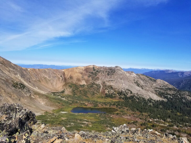
It’s no secret that Colorado is home to some of the most amazing hikes and bucket-list-worthy adventures. From the majestic alpine lakes of Rocky Mountain National Park to the infamous Southwestern Colorado views this list features the very best Colorado hiking trails you’ll want to check out!

This post may contain affiliate links. For more info, see my disclosures.
There are epic hikes throughout the entire state of Colorado! You can choose from quick 1-mile day hikes or strenuous overnight treks. No matter which trail you choose, you’ll surely be met with the most breathtaking views!
Whether you’re hiking with a group, your family or with your significant other, there are so many phenomenal trails across the great state of Colorado.
Generally, summertime is the best time for hiking in Colorado to avoid snowy weather and closed trails. However, that’s typically when the trails are the most crowded. Each hike within this guide includes the best time to hike the trail, as well as tips on how to make the most of each hike.
Let’s get to it!
Must-see video: Colorado hiking trails
Map of best Colorado hikes
To make your Colorado hiking planning extra easy, the following list is divided up into popular regions in Colorado (also noted by colors on the map below).
Throughout this list, you’ll find the best hikes in Rocky Mountain National Park, Colorado Springs hiking trails, the best hikes near Breckenridge, Telluride hikes, and other notable trails throughout the state.
Use this map (and the following list) to start planning your next Colorado hiking adventure!
Colorado hiking gear

It’s so very important to be prepared with the proper gear during your Colorado hikes! Below are some of my recommendations to make your hike successful.
- Bear spray. Bears are common in many parts of the state. Be prepared by carrying bear spray (each adult should have one on them at all times) while hiking.
- Hiking shoes. These are an absolute must! Anytime you’re planning to hike a non-paved path (the majority of Colorado hiking trails on this list), you’ll want grippy hiking shoes. Look for boots with good ankle support for rocky terrain.
- Trekking poles. They’ll help you on inclines, for stability on descents and keep you in rhythm when you’re tired. My entire family loves these hiking poles we’ve used across Colorado, as well as all the best national parks for kids.

- Hiking backpack. An essential item for hiking anywhere! It helps carry food, water, layers and any other safety gear you’ll need on your hike. My husband and I love our Osprey hiking backpacks, and my favorite hiking backpacks for kids are Sunhiker backpacks.
- Satellite communicator. National parks and many other areas of Colorado don’t have great (or any) cell phone reception. Use a satellite communicator that works without being in cell phone range, as a back-up emergency plan. I can’t tell you how many people over the years I’ve seen injured on a trail! For yourself or someone else on the trail, you’ll be thankful you have it in the time of need.
- Water and snacks. Be well prepared on your hike, and always take more than you think you’ll need. Grab a few reusable water bottles or fill a hydration bladder for your backpack. And grab nutrient-rich snacks like beef jerky or trail mix.
- First aid kit and other essentials. Be prepared by following the 10 essentials while hiking. You’ll likely need bug spray and sunscreen, too!
By the way, I’ve vacationed in Colorado more times than I can count, but haven’t been everywhere (yet). So I’ve asked a few of my fellow travel writers to help compile this list. Enjoy!

The best Colorado hiking trails
Woohoo! It’s time to dive into the best Colorado hiking trails list! I absolutely love Colorado so I’m sooo excited to share this epic Colorado hikes bucket list.
Let’s dive in!
1. Sylvan Lake Trail

- Hike distance: 5.4 miles
- Time: 2-3 hours
- Difficulty rating: moderate
- Best time to hike: summertime
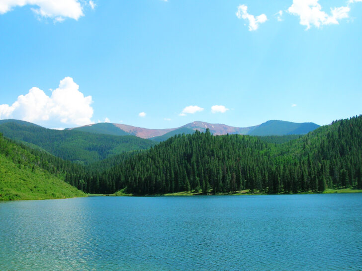
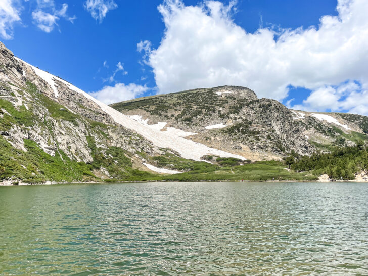
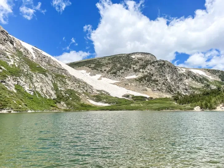
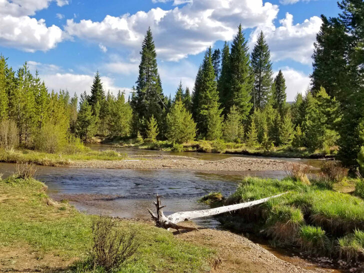
One of the best Colorado hiking spots – and a true hidden gem in the state – is in Sylvan Lake State Park. Coming in at 5.4 miles with an elevation gain of 1,669 feet in elevation gain, this hike offers spectacular views of the White River National Forest in the Rocky Mountains.
Located in Sylvan Lake State Park about 3 hours west of Denver, this small state park packs a punch. A beautiful lake creates a serene setting for nature lovers. Kayak and paddle board rentals are available at the lakefront from Memorial Day through Labor Day.
Visitors to Sylvan Lake State Park can also enjoy mountain biking, horseback riding, cross-country skiing or fishing on the lake.
There’s a walking trail around the lake about 1.5 miles, which is relatively flat and easy for most skill levels. However, the trail that offers the best views is the Sneve Gulch Trail. Just north of the cabins near the lake is the trailhead.
The Sneve Gulch Trail climbs through wooded terrain, gaining much of the elevation in the first mile. When the trail opens up to views of the lake, you’ll get beautiful views of the nearby mountains.
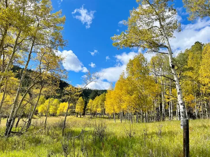
If you hike in the late spring and early summer, the mountains are likely to be covered in snow. Hiking the Sneve Gulch Trail in the fall brings views of yellow aspen trees. Be sure to carry bear spray with you on this hike as Black Bears are prevalent in the area.
The state park entrance fee is $10 per vehicle for a day permit and additional camping fees apply if you choose to camp at the lake.
Recommended by me – Nikki of Inspired Routes
2. Hanging Lake (one of the most popular Colorado hiking trails)

- Hike distance: 3 miles- 1,200-foot elevation gain
- Time: 2-3 Hours
- Difficulty rating: Moderate
- Best time to hike: Morning in the summer and any time of day in the fall
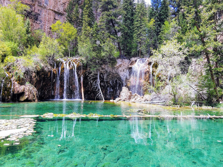
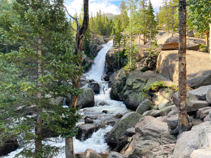
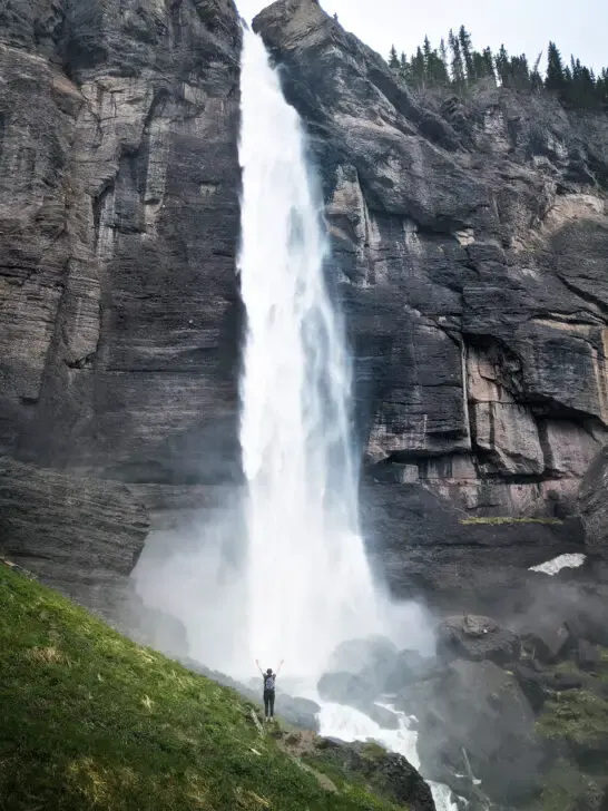
The hike to Hanging Lake is one of the best Colorado hikes! Located in a canyon, the green-hued lake seems to hang on a small ledge surrounded by steep cliffs and scenic waterfalls.
The water in Hanging Lake is crystal clear allowing you to see all of the details of the swimming brook trout. While the lake itself is a sight you will never forget, the hike to get there offers incredible views all along the way.
Hanging Lake trailhead is located along Interstate 70, just 150 miles from Denver in the beautiful Glenwood Canyon. If you plan to hike early, the nearby town of Glenwood Springs is a great place to stay the night before.
Because the hike to Hanging Lake is so amazing, the forest service put a reservation system into place to regulate the number of hikers each day. Reservations are $12 per person in the summer and $10 in the winter and the fee includes parking.
You can secure a reservation on the Visit Glenwood website. Try to secure your hiking reservation as far in advance as possible to get the time and day that you want.
There are some things you should know before hiking to Hanging Lake. First, no dogs are allowed on the trail. Also, the only bathrooms are at the trailhead so make sure to use the bathroom before you start your hike.
Finally, the Hanging Lake trail is prone to mudslides and the Forest Service will close the trail if there are heavy rains. For the best chance of good weather in the summer, reserve a hike early in the day. Storms usually don’t move in until afternoon.
Recommended by Diane of Travels With Eli
3. Treasure Falls

- Hike distance: 0.5 miles
- Time: 20-30 minutes
- Difficulty rating: Easy
- Best time to hike: Spring for full waterfall power, November-March for frozen waterfall magic
If you’re on the lookout for a short and sweet hike in Colorado, then Treasure Falls in Pagosa Springs is the perfect pick for you. As a local, I can tell you that this hike may be short, but it packs a big punch with its gorgeous 105-foot waterfall that cascades down a rocky cliff face.
And if you’re short on time or energy, don’t worry—the hike to the falls is just a half-mile loop, making it the perfect quick adventure. Plus, The trailhead is easy to access, located just off Highway 160, about 15 miles east of Pagosa Springs.
The hike to Treasure Falls is a well-maintained dirt path with gentle slopes, making it an easy hike for all ages and skill levels. The trail is shaded by tall pine trees, providing a cool and refreshing escape from the summer heat.
Now, if you’re looking to experience the full power of the falls, I highly recommend taking the short loop to the misty deck. Plus, if you’re visiting in the spring, you’ll see the falls at their most impressive.
Falls Creek swells with water, making for a stunning display of natural power. But, as a local, I have to admit that my personal favorite time to visit is during the winter months, from November to March.
During this time, the falls transform into something even more special. The waterfall freezes solid, creating an otherworldly landscape of sparkling blues and shimmering icicles. The cliffs reflect the sunlight in a dazzling display that you simply can’t miss.
Recommended by Nicoll of Living Tiny With a Wolf
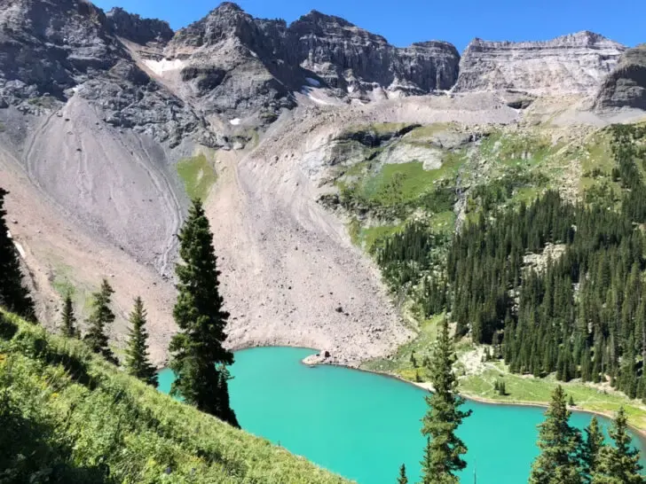
4. South Colony Lakes

- Hike distance: 8.9 miles
- Time: 6 hours
- Difficulty rating: Difficult
- Best time to hike: Summer
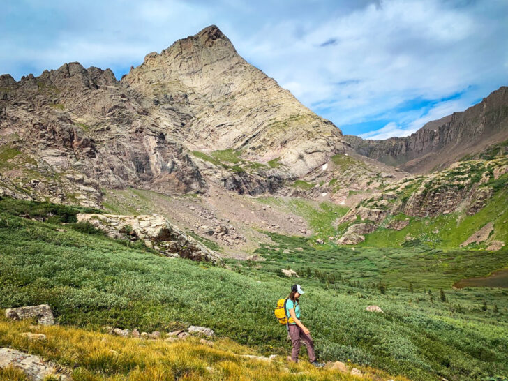
Looking for one of the best Colorado hiking trails? If so, then you can’t beat the South Colony Lakes hike in the San Isabel National Forest.
In fact, this hike is so scenic with Crestone Peak and the Crestone Needle – two of Colorado’s most famous 14ers – in the background that many people turn this fun day hike into a backpacking trip.
You will need a high clearance 4WD vehicle if you want to reach the upper trailhead, which is a great starting spot since it will remove about 3 miles and 1,000 feet of elevation gain from your out-and-back hike.
Once on the trail you’ll hike uphill through an alpine forest. You’ll likely see many deer and mule deer along the way. You’ll also see a bunch of campsites about 3 miles in.
Remember to go slow especially if you are not used to the elevation since your bag can easily weigh you down. Also, be prepared for wind since this area can get super windy.
Continue on and you’ll hit the lower and then upper lakes which are some of the best alpine lakes in Colorado. This is where the trail steepens and you’ll find some steps that make going uphill easier.
You’ll then hit a false summit and need to do a fun scramble over some large boulders before you finally hit the real summit and enjoy stunning views of the region.
Recommended by Meg of Fox in the Forest
5. St Mary’s Glacier (an underrated Colorado hiking trail)
- Hike distance: 2.4 miles
- Time: 1.5 – 2 hours
- Difficulty rating: moderate
- Best time to hike: spring or fall before 12 pm
Just a short drive from Denver, St Mary’s Glacier is easily one hike that should be added to your Colorado hiking list. It’s situated in Idaho Springs.
Though it initially has quite an elevation gain, it’s a short trail with some of the most impeccable mountain views you can get without heading into Rocky Mountain National Park.
The trail begins rather steep as you scramble up rocks. Wear sturdy hiking boots that protect your ankles for this trail, or you’ll regret it.
After a little bit of walking up steeply, the trail levels out and continues until you see a breathtaking lake surrounded by mountains. Many people opt to stay right in this spot and enjoy the view, or you can continue up to the glacier. Make sure you bring equipment if you plan on going up any higher.
There is ample parking at the base of the trail, but there is a $5 parking fee in cash. In the summer months, parking can be a bit harder to come by depending on the time of day you decide to hike, so it’s recommended that you start as early as possible.
Vault toilets are open for public use on-site in case you need to use the restroom before or after your trek.
As recommended by Krystianna of Volumes and Voyages
6. Mt. Elbert
- Distance: 9.5 miles roundtrip
- Time: 4 – 6 hours
- Difficulty: Hard
- Best Time to Hike: May – October / Early Morning
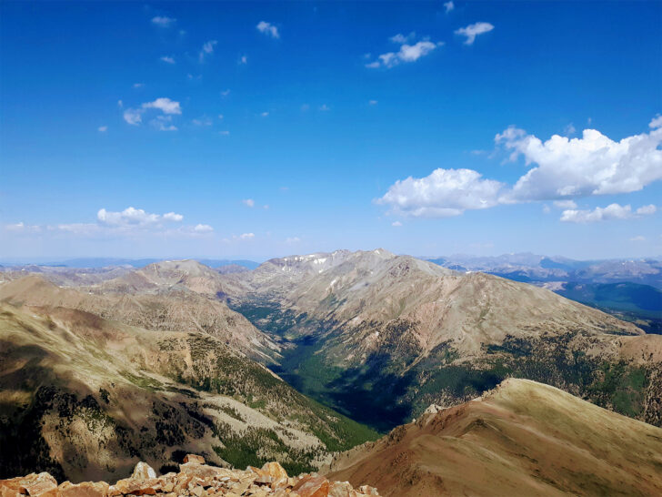
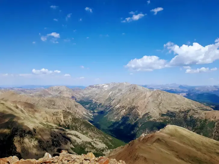
Mt. Elbert deserves to be on the list of best Colorado hiking trails because it is literally a “top” Colorado hike. It’s actually the highest point in the entire state of Colorado!
In fact, Mt. Elbert is the 2nd highest peak in the entire lower 48 states, second only to California’s Mt. Whitney, another U.S. state high point. The views are guaranteed to be breathtaking!
From its summit, you can enjoy the colorful peaks of the surrounding mountain ranges, and the pristine views of Twin Lakes below!
You can find this bucket list Colorado hike just outside of Leadville, Colorado. It’s close to other neighboring peaks like Mt. Massive.
As with all hiking trails, there are several important considerations for hiking Mt. Elbert. There is almost 4,500 feet of elevation gain, so hikers should be ready for that type of strenuous uphill climb!
Mt. Elbert is a 14,’er, which means there is a risk of altitude sickness. Make sure that you have properly acclimated before attempting Mt. Elbert.
This is a very popular trail, especially in the late spring through early fall hiking season. Plan to arrive early at the trailhead to secure parking. Parking fills up very quickly and early, especially on the weekends.
Another reason you should arrive early and start hiking early is to ensure being off the summit and descending by noon – a general rule for summit hiking in order to avoid afternoon thunderstorms.
There are bathroom facilities at the trailhead, but the lines can get long due to the popularity of the trail.
There are no fees to hike Mt. Elbert, which means you get to enjoy the unbelievable views and daunting challenge completely for free!
Recommended by Kristen of Yonderlust Ramblings
Best hikes in Rocky Mountain National Park
Rocky Mountain National Park is definitely the most popular region for hiking in all of Colorado. The park covers over 265,000 acres and has 300+ miles of maintained hiking trails. Keep in mind, you’ll need a timed entry reservation to see the Trail Ridge Road from mid-May through late-October.
Below are some of the best hikes in Rocky Mountain National Park!
7. Coyote Valley Trail

- Hike distance: 2.1 miles
- Time: 1 hour
- Difficulty rating: easy
- Best time to hike: April – November
If you’re looking for a scenic trail without much effort, the Coyote Valley Trail is for you! Located on the western side of Rocky Mountain National Park, this trail offers sweeping valley views and runs along the a stream.
The trailhead for Coyote Valley Trail is along the famous Trail Ridge Road, which means that late May through late October, you’ll need a timed entry permit to access this part of the park. Plan in advance for your trip to Rocky Mountain National Park!
Perfect for all ages and really flat, this trail is a mix of concrete and gravel. The majority of the trail is concrete, which is wheel chair and stroller friendly, too! After the technical end of the trail is a dirt path you can follow, which weaves through the river and continues through the valley, if you’re looking to add length and adventure to the trail.
This trail is known for its wildlife, especially near dawn or dusk. Moose, coyotes, elk and deer are common to see in the meadow.
This is one of the best Colorado hikes that’s ADA accessible and perfect for young children and great scenery!
Recommended by me – Nikki of Inspired Routes
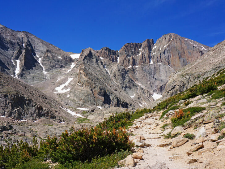
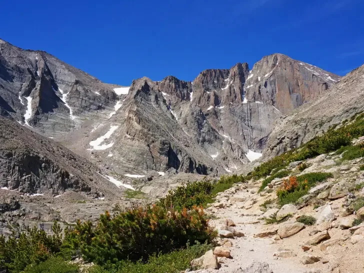
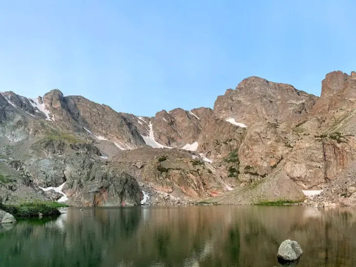
8. Chasm Lake
- Hike distance: 8.5 miles
- Time: 6-8 hours
- Difficulty rating: Difficult
- Best time to hike: June-October, best to start in the morning
Situated beneath the sheer granite wall that forms the eastern face of Longs Peak, Chasm Lake is arguably the most spectacular alpine lake in Colorado.
The out-and-back hike to reach the lake is equally as wonderful, with fantastic views, waterfalls, and interesting landscapes. The trail climbs steadily for much of the hike, starting in pine forests and then traversing alpine tundra dotted with wildflowers.
Hikers will enjoy sweeping views of the Front Range and Longs Peak for much of the hike, as well as getting to visit Columbine Falls and Peacock Pool on their way.
The hike starts at the Longs Peak Trailhead. It can be accessed from the Longs Peak Ranger Station in Rocky Mountain National Park and just down the road from a nice campground.
The parking lot at the trailhead fills up quickly on summer weekends, but there is additional parking along the road. There’s a vault toilet at the trailhead and an outhouse located 2.5 miles along the trail.
Although the Longs Peak Ranger Station isn’t always manned, you are still technically required to purchase a pass to enter the national park.
Snow often lingers along the trail well into June, which can be challenging on steep and exposed sections. If attempting the hike before July, it’s a good idea to bring microspikes.
Additionally, afternoon thunderstorms are very common in the summer months, which can be dangerous given that most of the Chasm Lake Hike is above treeline. Getting an early start on this Colorado hiking trail is the best way to minimize your risk of getting caught in a storm.
This is by far one of the best Colorado hiking trails if you’re looking for a challenge!
Recommended by Ian of TMBTENT
9. Sky Pond

- Hike distance: 8.6 miles
- Time: 5-6 hours
- Difficulty rating: Difficult
- Best time to hike: Summer or Early Fall
The hike to Sky Pond is considered one of the best hikes in Rocky Mountain National Park with stunning waterfalls and alpine lake views.
The trail begins at the Glacier Gorge trailhead along Bear Lake Road. You will need a park pass at all times of the year, as well as a timed entry reservation to reach the trailhead during the summer and fall months. Park passes can be purchased for 1 day for $30 or 7 days for $35.
The parking lot at the Glacier Gorge trailhead is small, with room for only 20-30 cars; alternatively, you can park at Bear Lake or use the park shuttle. There are restrooms located at the trailhead.
Once you begin your hike to Sky Pond, you’ll quickly cross beautiful streams including Tyndall Creek before reaching the first waterfall, Alberta Falls. Enjoy the views of the waterfall on the way up because it does get busy midday, so you can breeze right by the crowds on your return.
After enjoying Alberta Falls, you’ll continue to the first of three lakes, the Loch. This is a great spot to stop for breakfast or a snack because the next section of the trail can be difficult!
You’ll scramble up boulders on your climb alongside Timberline Falls. You’ll need all four of your limbs for this scramble, but at the top of the falls, you’ll reach the second alpine lake, Lake of Glass.
Sky Pond is only about 0.5 miles past Lake of Glass, and the alpine meadows surrounding this stretch of trail are beautiful. After you enjoy Sky Pond, you’ll return on the same trail you came, but the sweeping valley views below are fantastic.
The views along the trail to Sky Pond certainly make it one of the best Colorado hikes.
Recommended by Samantha of PA on Pause
10. Alberta Falls (one of the most popular hikes in Rocky Mountain National Park)

- Hike distance: 1.6 miles
- Time: 1 hour
- Difficulty rating: Easy
- Best time to hike: Summer is the perfect time for this hike without snow, dry trails, and a flowing waterfall!
While there are many waterfalls in Colorado, several of them take a lot of effort to access. Alberta Falls is an easy hike in Rocky Mountain National Park with a gorgeous waterfall that hikers of all skill levels can enjoy. It’s definitely one of the best (and easiest) Colorado hiking trails.
The hike to Alberta Falls winds through the dense forest with plenty of shade. There are a few gentle streams to cross, common wildlife sightings, and beautiful wildflowers. There is a slight elevation gain, but the hike is still relatively easy.
Visitors will hear the rushing water as they approach the falls, and once they do, will find a beautiful waterfall rushing down the mountain and through a small gorge.
Morning is the best time to photograph Alberta Falls before shadows start to cast across the cascade. If they are lucky, hikers will see a rainbow across Alberta Falls in the sunlight.
Plenty of boulders allow for climbing up the side of the falls or resting on them with a snack before hiking back down.
Alberta Falls departs from the Bear Lake Trailhead which means that timed entry reservations are required to enter the park in addition to the national park pass.
Visitors should enter early in the morning to secure a parking spot or plan to take the shuttle from another parking lot. Restrooms are available at the trailhead as well as a ranger station offering information and educational displays.
Recommended by Sierra of Island and Alpine
Colorado Springs hiking trails
While Colorado Springs has some pretty great hikes, here are just a couple options for you. From relatively easy to fairly difficult, these are the note-worthy hikes in the area.
11. Siamese Twins Trail, Garden of the Gods
- Hike distance: 0.9 miles
- Time: less than 1 hour
- Difficulty rating: easy
- Best time to hike: morning, March through November
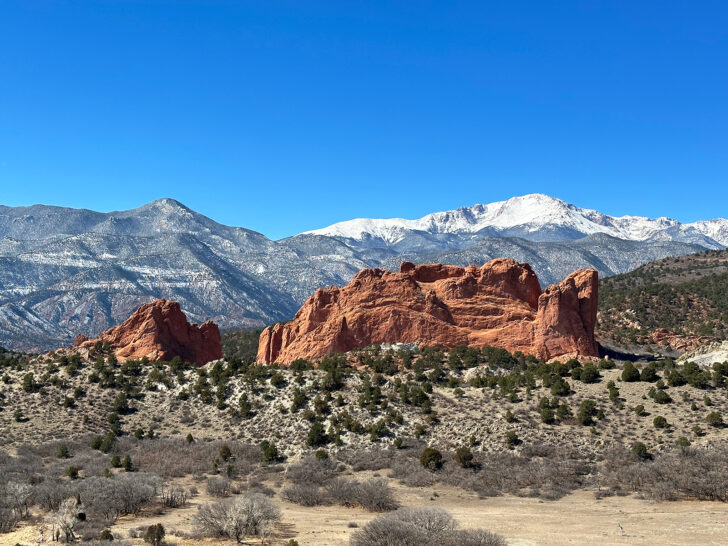
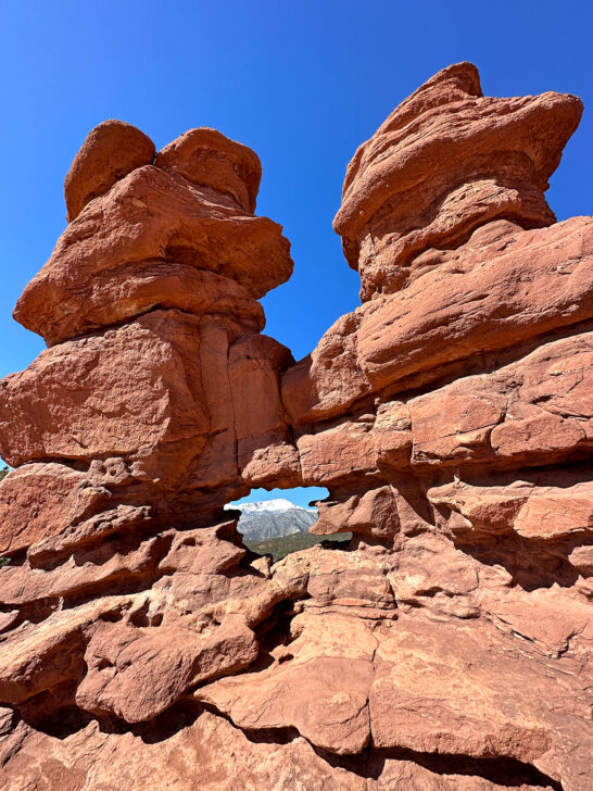
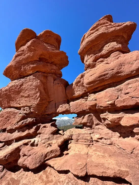
Garden of the Gods is truly a gem in Colorado, and with more than 4 million visitors per year, the Siamese Twins Trail is one of the best Colorado hikes you can do for free! As a bonus, the entire Garden of the Gods is dog-friendly, as long as they’re on leashes and picked up after.
While most visitors flock to the center of the park, and the paved Perkins Central Garden Trail, which is honestly quite cool to walk through the massive rocks. But at the west end of the park is another hike that provides impressive views, the Siamese Twins Trail.
Coming in at less than one mile from the trailhead, this loop hike takes you to a rocky formation that are two adjoined jagged peaks, giving the rock its name, Siamese Twins. If you go on a clear day, you’ll be able to line up Pikes Peak through a hole in the rock, too!
The trail is mostly dirt with some slick rock at the Siamese Twins Rock. You could do it in regular athletic shoes but grippy hiking shoes would be better for the viewpoint. It would be very easy to slip otherwise! If you plan to hike the trail in the winter, be sure to check for snow or wear crampons during the hike.
The trailhead gets quite busy, especially on weekends so plan to go early to get a parking spot. Alternatively, you can park by the Garden of the Gods Trading Post, which will add about 0.5 miles to the overall hike.
The Siamese Twins Garden of the Gods is a fun hike for all ages, and one that provides great views for little effort.
Recommended by me – Nikki of Inspired Routes
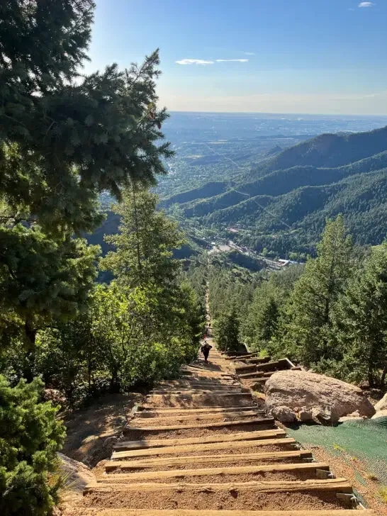
12. Manitou Incline

- Hike distance: 4 miles
- Time: 3 hours
- Difficulty rating: Difficult
- Best time to hike: Spring, summer, fall – makes a great sunset hike!
With 2,744 steps that head straight up for around 2,000 feet of elevation gain in just under a mile, the Manitou Incline is a challenge that belongs on any Colorado hiker’s bucket list.
The iconic steep Manitou Incline is definitely one of the most popular hikes in Colorado Springs (technically it’s next door in the town of Manitou Springs), with around 70,000 hikers attempting to climb it each year.
While climbing, you’ll find a bail-out option about two-thirds of the way to the top, but if you reach the summit, you’ll be rewarded with a sense of accomplishment plus a stunning view out over Colorado Springs. Head down the forested Barr Trail for the 3-mile descent back to the trailhead.
Because of the popularity, a free online reservation is required to hike The Incline from 6am-6pm daily. You’ll want to make reservations well in advance during the busy summer season, especially on weekends.
Parking at the trailhead is $10/day and fills up fast. A good alternative option is to take the free shuttle which runs every 20 minutes throughout the day (6am-6pm) from downtown Manitou Springs to the trailhead.
The Manitou Incline is a must-do Colorado hike to test your legs (and lungs) on this outdoor stairmaster!
Recommended by Allison of She Dreams of Alpine
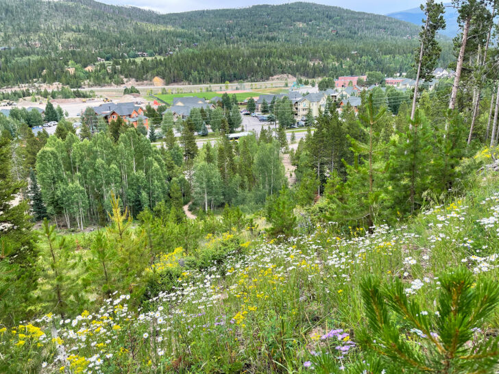
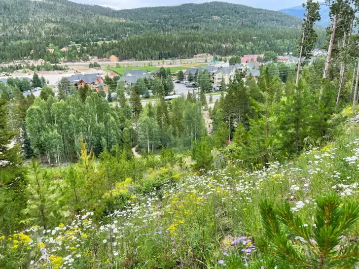
Best hikes near Breckenridge
Although Breckenridge is known for being a premier skiing and snowboarding destination, the hiking scene should not be overlooked! Check out these breathtaking hikes near Breckenridge!
13. Sapphire Point Overlook
- Hike distance: 0.6 miles
- Time: 30 minutes
- Difficulty rating: easy
- Best time to hike: May – October
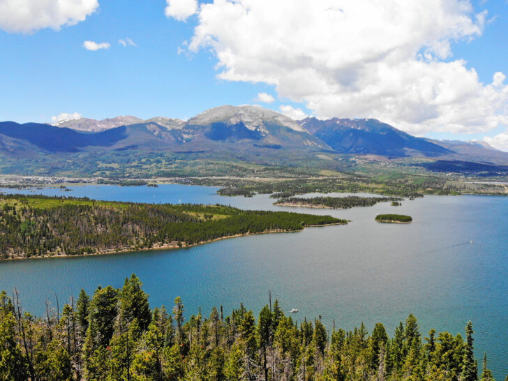
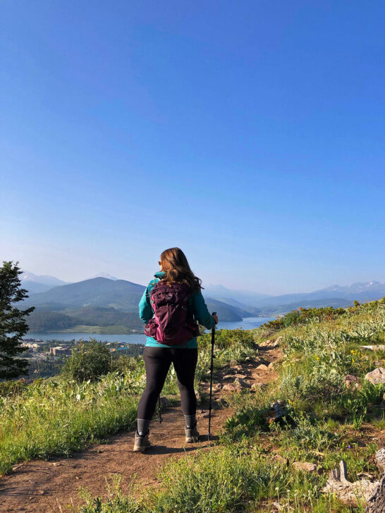
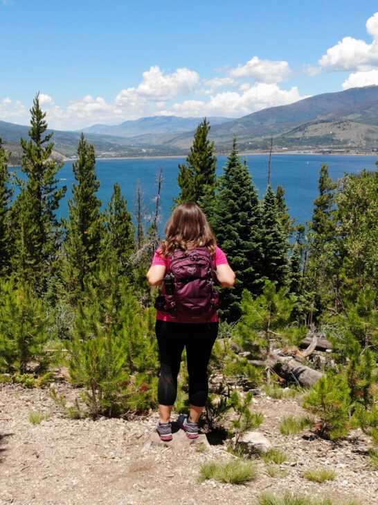
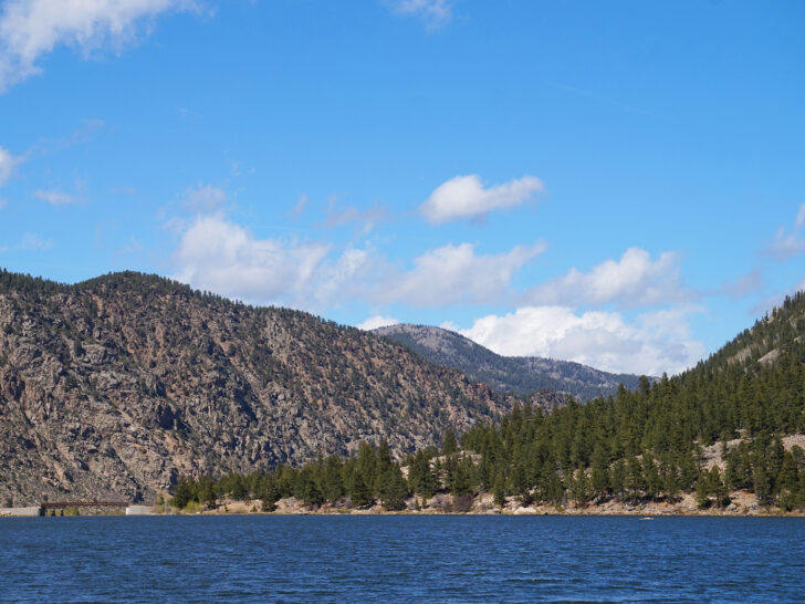
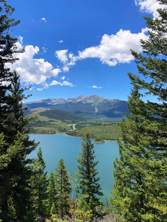
This is one of the most well-known overlooks near Breckenridge and Dillon, Colorado. Located on the Dillon Reservoir, the entire area is so beautiful. The Sapphire Point Overlook is aptly named based on the color of the water. When the sun hits it just right, it’s stunning!
Located in White River National Forest between Breckenridge, Fresco and Dillon, Colorado, it’s a popular area for hiking, scenic drives and of course – overlooks.
The entire loop trail will take you under 1/2 hour, depending on how many stops you make. From the parking lot, if you walk the loop in a counter-clockwise position, you’ll get to the overlook quite quickly.
After you reach the overlook, continue along the trail. It provides several scenic views of the lake. The rest of the trail has a lot fewer hikers, too. There’s a few picnic tables, which would be a perfect spot to enjoy a snack or lunch.
It’s a popular spot and gets quite busy. If you go on a weekend, you might even see a wedding at the overlook because it’s such a beautiful spot! The parking area is relatively large, but definitely can get full. Good news is that you likely won’t have to wait long until a space is free.
This hike is free and the best time of year to go is when there’s no snow, unless you bring snowshoes. If you can go on a sunny day, you’ll get views of those blue sapphire waters!
Although really easy, this spot is deserving to be on this list of the best Colorado hiking trails!
Recommended by me – Nikki of Inspired Routes
14. Iowa Hill Trail
- Hike distance: 2 miles
- Time: 1 hour
- Difficulty rating: Moderate
- Best time to hike: Wildflowers fill the meadows along the trail in late summer, but the trail is open year-round and fun in snowshoes too!
Breckenridge, Colorado’s Iowa Hill Trail is a beautiful, easy trail that starts just one mile from Main Street. It’s an excellent family-friendly Colorado hiking trail!
It winds along the mountain through the wildflowers and green meadows, with elk meandering nearby. You’ll also notice the unique feature of mining history sprinkled throughout the hike.
It is possible to hike just a .7-mile loop from the trailhead, but doing so will cause hikers to miss the mining experience. Take each side trail from the main trail to explore all this hike has to offer and the hike will end up being about 2 miles long with a 400-foot elevation gain.
Interpretive signs take hikers back in time to gold mining days with plenty of old equipment to explore and history to learn, such as mining carts, sluices, tools, and old cabins. Children will love this hiking activity in Breckenridge as there is plenty for them to explore.
The landscape is gorgeous, especially in early summer. Close to the end of the trail, hikers will reach the peak which offers expansive views of the town of Breckenridge below. Columbine flowers grow along the trail, as well as many other varieties of wildflowers.
Free parking is available in the lot at the Iowa Hill Trailhead, but the lot is small, so be prepared to wait if you visit on a busy weekend. No restrooms are available at this trailhead.
Recommended by Sierra of Island and Alpine
15. Ptarmigan Trail (an underrated and amazing Colorado hiking spot)

- Hike distance: 4.6 miles
- Time: 2.5 – 3.5 hours
- Difficulty rating: moderate
- Best time to hike: May – October
If you’re looking for a moderately challenging trail that’s not tied to a popular national park or tourist area, this trail is for you! The Ptarmigan Trail is a good workout with worthy views.
Coming in at 4.6 miles with an elevation gain of 1,141 feet, this trail is a fun one to hike. This dog-friendly trail provides views of the Rocky Mountains and the Dillion Reservoir. If hiking on a weekend, be sure to get to the trailhead early in the day to avoid parking issues.
The Ptarmigan Trail starts out really steep – the first 1/2 mile is the hardest on the trail! Afterwards, you’ll go through a variety of terrain and views from scenic lake views to forested areas. The trail officially ends at a bench and overlook of the mountains. There’s a dirt path to continue a few more miles up, if you’d like.
Be sure to wear good hiking shoes (or snowshoes in the winter) and carry bear spray on this trail. You may see wildlife like bear, elk, deer and more on the Ptarmigan Trail.
Recommended by me – Nikki of Inspired Routes
Telluride hikes (some of the best Colorado hiking trails)
Telluride is a favorite mountain town in the state of Colorado by many visitors! Beyond the cute shops, the city gondola, and charming Main Street, you’ll also find some out-of-this-world hiking trails. Here are the top Telluride hikes to add to your Colorado hiking list!
16. Blue Lakes Trail
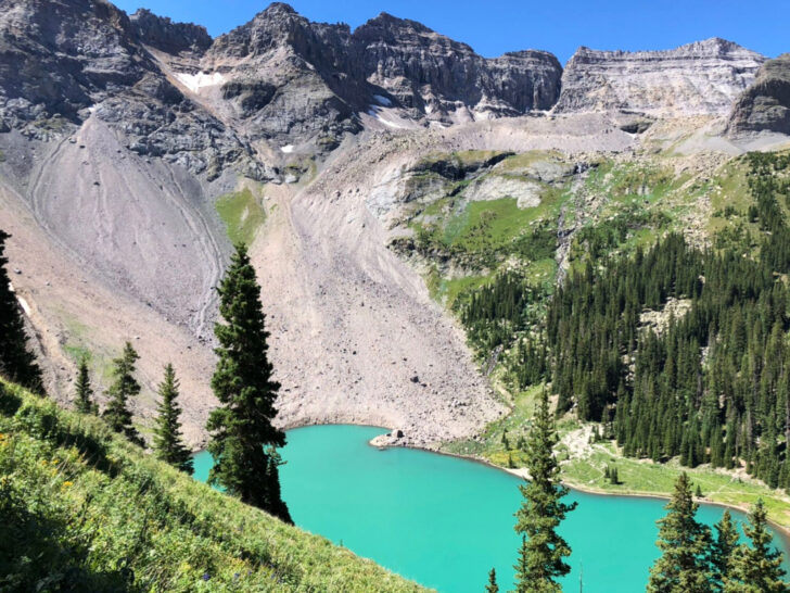
- Hike distance: 8.7 miles roundtrip with 2,509 feet elevation gain
- Time: 5-6 hours
- Difficulty rating: Hard if you go to the second and third lakes
- Best time to hike: July-September when the lakes are thawed and the trail is free from snow. Go early in the morning to avoid heat and crowds- this hike is very popular and can get crowded.
The Blue Lakes Trail is a dog-friendly trail located 45 minutes outside of Ridgway, Colorado to three different stunning lakes. It’s a gem on this best Colorado hikes list!
There’s a long bumpy dirt road to reach the trailhead, passable for any car as long as the road is dry. There are no permits needed or fees to pay and pit toilets are located at the trailhead.
Climb an initial 3.5 miles through a pine forest to reach the first lake. You can also set up camp here if you wish to backpack. Enjoy this spot for a bit but keep going- the best views are still to come!
The trail from the first lake to the second is short and steep, gaining over 600 feet in just 0.7 miles– but so very worth it.
The best view is found above the first lake- where you are surrounded by mountain peaks, lush green vegetation, and wildflowers. You can truly appreciate its bright blue opaque color. This is truly one of the best lake views in all of Colorado.
The second lake is bigger and much a darker shade of blue. Continue 0.3 miles onto the third lake and you will have a greater panoramic view of Colorado’s high peaks all around you. The farther you go, the less crowded the trail is and you can just bask in all that nature has to offer.
Enjoy lunch at the third lake and a long break to soak up the views before heading back down.
Recommended by Kate of Kate Roams the World
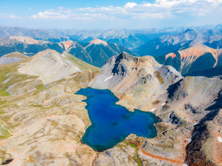
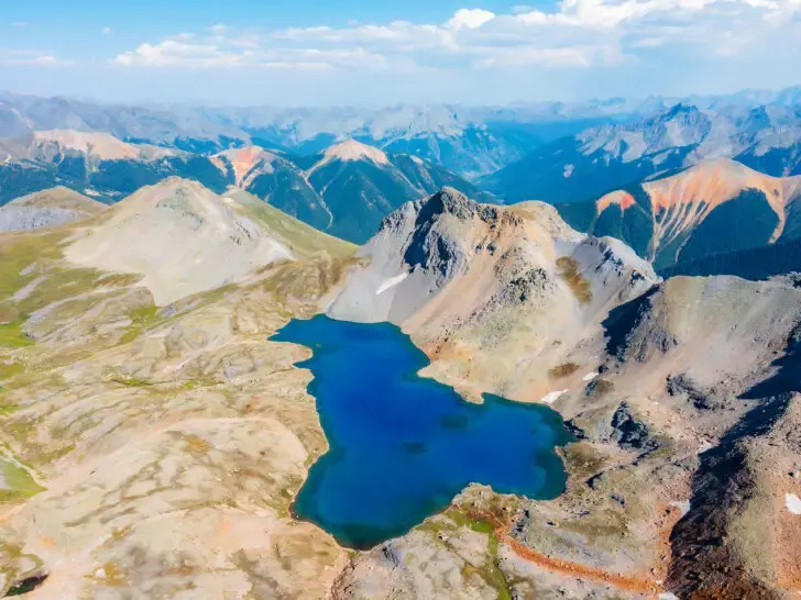
17. Columbine Lake Trail (one of the absolute best Colorado hikes)
- Hike distance: 8 miles and 2,900 feet of elevation gain
- Time: 3-3.5 hours up
- Difficulty rating: Hard
- Best time to hike: Summer and start early in the morning
The San Juan Mountains are home to some of the most gorgeous views in the entire country. With peaks towering above 14,000 and iron and ore causing mountain sides to come to life with red colors, it’s a sightseeing dream and an epic destination for Colorado hiking.
Columbine Lake, one of the bluest lakes in Colorado, is among those peaks. At 12,700 feet, it’s also one of the state’s highest lakes. This means hikers need to work in work to reach such a beautiful area. But it’s worth it.
Drive 15 minutes north of Silverton to get there and exit onto Ophir Pass Road – 679. Just after the bridge will be a parking lot. You can park here and walk up the road to the official trailhead, or if you have a high-clearance vehicle, you can drive the .75 miles. The parking lot is small, so come early to beat the crowds.
Once your hike begins, it’s a strenuous climb for the first mile, consisting of endless switchbacks. The only good thing is it’s in the shade.
Once you’re through the switchbacks, a long, unshaded ascent will begin in a large basin. This section is mild, but the elevation still made it challenging.
Finally, at the 2.5-mile mark, the trail flattens out, and you enjoy miles and miles of beautiful Colorado landscapes as you make your way to the deep blue lake. When you arrive, you’ll be in love with the scenery.
The towering peaks behind the lake will captivate your mind, and you won’t want to leave. And no one will blame you! This is by far one of the best Colorado hiking trails if you want a challenge!
Recommended by Alec of Explore with Alec
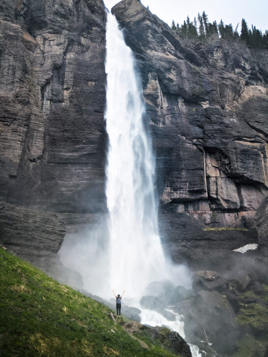
18. Bridal Veil Falls
- Hike distance: 4.8 miles (round trip)
- Time: 2-3 hours
- Difficulty rating: Moderate
- Best time to hike: Late spring to early fall
If you’re in Colorado and looking for a hike that’s sure to impress, Bridal Veil Falls is one of the best hikes near Telluride. This towering 365-foot waterfall is one of the tallest free-falling waterfalls in the state, and the hike to get there is an adventure in itself.
The round-trip hike is approximately 4.8 miles, so be sure to bring plenty of water and snacks to keep your energy up. The hike is rated as moderate, so you’ll definitely break a sweat. The stunning views of the waterfall and the surrounding mountains make it all worth it.
Hikers should come prepared with good hiking boots, especially since the trail can be quite rocky, rooty, and windy. In fact, some hikers may find the hike challenging, so it’s best to take it slow and steady.
One option for hikers is to take the hiking trail up to the falls and then the road back down, which can be easier on the knees and provide a different perspective of the surrounding mountains.
Late spring to early fall is the best time to go, as the trail can be slippery and difficult to navigate during the winter months. Plus, mid-morning to early afternoon is the perfect window to hike since you’ll have plenty of sunlight to illuminate the falls and the trail.
One of the best parts of this hike is that you’ll be treated to stunning views of the surrounding scenery throughout your journey. You’ll pass through aspen forests, cross babbling brooks, and walk along narrow paths carved into the mountainside.
When you reach the falls, you’ll be greeted by the roaring sound of the water as it cascades down the cliff.
Recommended by Nicoll of Living Tiny With a Wolf
19. Ice & Island Lakes Trail (a fun one on this list of best Colorado hiking trails)


- Hike distance: 7.7 miles roundtrip with 2,680 feet elevation gain
- Time: 5-6 hours
- Difficulty rating: Hard
- Best time to hike: July-September when the lakes are thawed and the trail is free from snow. Go early in the morning to avoid heat and crowds- this hike is very popular and can get crowded. Go in late September-early October to see Aspens’ change in this area.
A hike to Ice and Island Lakes is a must on your Colorado hiking trails bucket list. You’ll find this trail nestled in the colorful San Juan mountain region of Southwest Colorado, which is about a 20-minute drive outside of Silverton.
The trailhead is accessible via a dirt road that is passable with any car when the road is dry. This dog-friendly trail is free to hike and a permit is not needed. Across the street from the trailhead is South Mineral Campground where they have pit toilets for use.
You’ll hike a little over 2 miles before getting above the treeline to where everything really opens up. In the summer there are wildflowers lining the trail and some waterfalls along the way making it a really beautiful journey.
Climb another steep mile before reaching the spectacular, electric blue Ice Lake.
Then, hike the rather flat last 0.5 miles to Island Lake to see its turquoise green waters. Spot the rock in the middle of it where it gets its name of Island Lake. You can also backpack and set up camp for the night at either of these lakes.
While the hike is challenging, the unmatched beauty of each lake with the mountain views and wildflowers make it one of Colorado’s best hikes. With both of these lakes being so close in proximity, yet looking completely different, it’s like you’re getting a 2-for-1 deal on this hike!
Recommended by Kate of Kate Roams the World
More Colorado hiking trails
Can you believe the beauty of Colorado?! It’s amazing how many impressive hikes can be in one state. Keep reading for more of the best Colorado hiking trails!
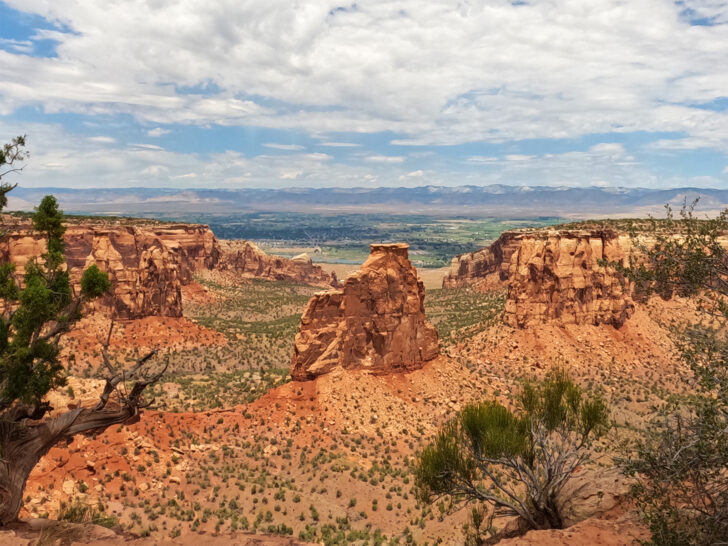
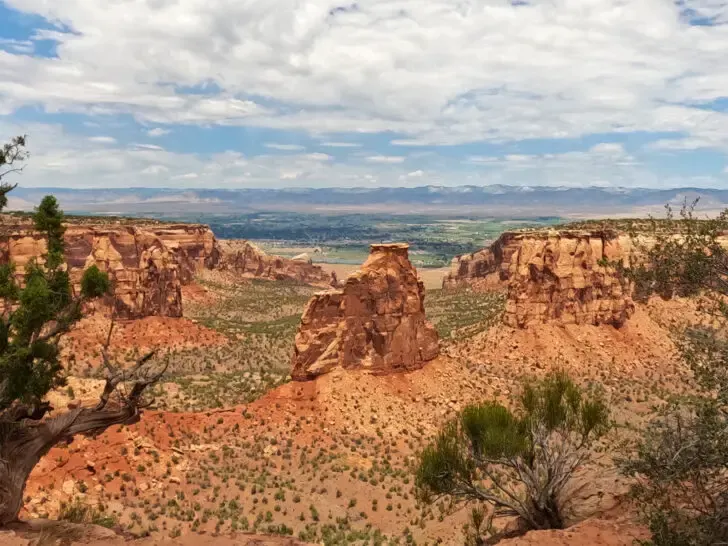
20. Otto’s Trail, Colorado National Monument
- Hike distance: 0.7 miles
- Time: 30 minutes
- Difficulty rating: easy
- Best time to hike: anytime
The most western location of all the trails on this list of the best Colorado hikes, get expansive views of the Colorado National Monument on Otto’s Trail. This short hike is a fun one when you’re visiting the monument or doing the scenic Rim Rock Drive.
Easy to do most of the year, you may be met with snow or slush in the wintertime, and of course heat in the summertime. It’s western, desert locale makes it drier and less snowy than many of the other hikes on this list so hiking is relatively easy year-round. Just grab your bug spray in late summer and fall!
Near the Visitor Center along the Rim Rock Drive, the trailhead is easy to find and you’ll typically find parking is accessible at Otto’s Trail.
The features on this trail are great views of the valley plus Independence Monument, Praying Hands and Sentinel Spire, which are all rock formations within Colorado National Monument.
There are some exposed edges, so just watch young children carefully!
Because the Colorado National Monument is part of the national park system, you can pay a per-vehicle fee at the entrance, or get inside with your American the Beautiful pass.
Recommended by me – Nikki of Inspired Routes
21. Bennhoff Lake Trail

- Hike distance: 1.5 miles
- Time: 30-45 minutes
- Difficulty rating: easy
- Best times to hike: late spring to early fall to avoid snow accumulation on the trail; mornings are best for spotting bighorn sheep
The perfect introduction to Georgetown, Colorado, is the Bennhoff Lake Trail. It’s an easy 1.5-mile loop hike with spectacular views.
The Bennhoff Lake Trail is the perfect place to stretch your legs while on a Denver to Grand Canyon road trip as it is just off I-70.
Start your hike near the public bathrooms off of 22nd Street (a must for families with little hikers!), then work your way around the lake on the clearly marked trail.
If you do the hike clockwise around Georgetown Lake from the bathrooms, you’ll soon come to the Georgetown Bighorn Sheep Wildlife Viewing Area. Use the binoculars to see if you can spot some of these beautiful animals roaming the steep mountainsides around the lake.
You’ll also walk over an old railway bridge, which provides excellent views of the lake.
For the second half of the hike, you’ll wind your way in and out of the tall pines and spruces at the base of Saxon Mountain. The lake is easily visible nearly the entire time.
You’ll end the hike slightly down 22nd Street from where you started. When you’ve completed the hike, head into historic Georgetown’s downtown to shop, eat and explore.
Add the Bennhoff Lake Trail to your must-do Colorado hikes list! For such an easy trail, the views you’ll get of the mountain, lakes, and scenery are incredible. It’s the perfect way to immerse yourself–and your family–into the beauty of the Rockies.
Recommended by Natalie of Camping Kiddos
22. Flatiron Loop Trail

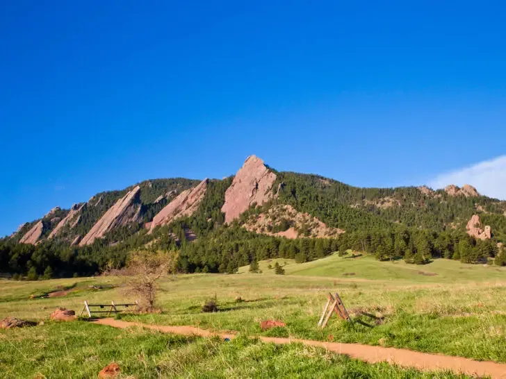
- Hike distance: 2.4 miles
- Time: ~2 hours
- Difficulty rating: Moderate
- Best time to hike: April-October
One of the most iconic things you can do in Colorado is a hike to the top of the Flatirons. They are impressive, slanted sandstone formations that are one of the most important landmarks in Boulder.
Once home to several Native American tribes and an inspiration for numerous artists and writers, Flatirons plays a significant role in the region’s history.
There are a variety of trails, many of which start from the Chautauqua Trailhead off Baseline Road. However, the Flatirons Loop is one of the famous ones.
It’s a 2-mile option that takes roughly 2 hours. This trail is an easy-to-moderate hike with a steady incline, and the views both on top and along the way are nothing short of spectacular.
You will find lots of places to stop for photos and rests, passing beautiful Mariposa Lilies and poison ivy, open meadows, lush pine trees, and even rock falls.
The best time to hike this loop is between April and October. It’s also as beautiful in winter, but the grounds can get slippery so wear microspikes and make sure to bring trekking poles.
Do arrive early if you need a parking space as it can get quite busy. On weekends in the summer months, the Park-to-Park shuttle offers free service to and from Chautauqua Park.
The Park is a nice place to have a picnic right after your hike. There are also restrooms and a tourist information center at the trailhead. After exploring, you’ll surely agree that the Flatiron Loop is one of the very best Colorado hiking trails!
Recommended by Bradley of Dream Big Travel Far
23. Fourth of July Trail (one of the best Colorado hiking destinations)

- Hike distance: 8 miles
- Time: 3 hours and 30 minutes
- Difficulty rating: moderate
- Best time to hike: May through September
Near Nederland and about an hour outside of Boulder, Colorado and is the locally popular Fourth of July Trail. This trail offers incredible views of Roosevelt National Forest as you ascend, culminating at a pristine alpine lake. During the spring and summer, you’ll find wildflowers blanketing the grassy areas.
In the summer this is a fabulous hike for intermediate or even beginner hikers, but you may need snow/ice gear in the winter. The trail does go above treeline, so be sure that you’re prepared for the altitude and bring plenty of water, sun protection, and layers in case it gets chilly.
Be aware that the road to the trailhead requires that your car have a decent amount of clearance, especially for the last few miles. Take your time and drive slowly to avoid any damage.
You’ll want to arrive as early as possible to ensure you get a parking spot and are able to summit before any summertime storms roll in.
This area is popular for camping, so you could pitch a tent or choose to stay in a hotel in Boulder. After experiencing one of the best Colorado hiking trails, you can visit one of the breweries or restaurants for dinner on Pearl Street in Boulder to reward yourself.
Recommended by Amber of Amber Everywhere
24. Maroon Bells (a favorite of the best Colorado hikes)

- Hike distance: 1.9 miles
- Time: 45 minutes-1 hour
- Difficulty rating: Easy
- Best time to hike: May-October
Located in the White River National Forest on the outskirts of Aspen, Maroon Bells is literally the most famous landmark hike in Colorado. Even if you think you’ve never heard of it, you’ve likely seen photos. It’s often the poster child for Colorado tourism advertising campaigns.
To say Maroon Bells is stunning is an understatement. The iconic peaks viewable from the path and in many seasons covered in snow make you truly feel that you are in the expansive wilderness of the Rockies.
There are quite a few hikes at Maroon Bells, from multi-day hikes and peak attempts to the most famous, the 1.9-mile hike takes you in a loop for a 360-degree view of the area.
You’ll get the opportunity to get great photos from spots such as Maroon Lake (which is also a great place with benches to sit and admire nature).
The hike itself is considered easy, it’s relatively flat and well-marked. However, during the spring there can be times when the bridge and some areas are flooded making it difficult to pass.
Getting to Maroon Bells requires visitors to travel about 9.5 miles along Maroon Creek Road to reach the trailhead. It costs $10 per vehicle to enter this area of White River National Forest, although folks with an America the Beautiful or other interagency pass can get the fee waived.
During peak season (mid-May to mid-October) visitors can only park at the trailhead before 8am or after 5pm and are required to take a shuttle to visit the site. Pets are allowed on some of the trails for Maroon Bells, be sure to read the signage for restrictions.
Recommended by Anwar of Beyond My Door
25. Fish Creek Falls Trail

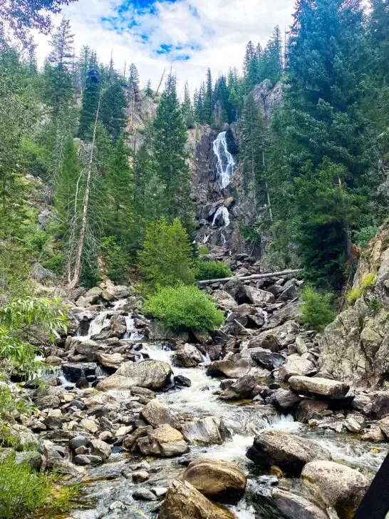
- Hike distance: 4.7 miles
- Time: 2.5 – 3 hours
- Difficulty rating: Hard
- Best time to hike: Early June – Mid-September (snow dependent) Make this an early morning or late afternoon hike to easily find parking and avoid the crowds visiting the main waterfall.
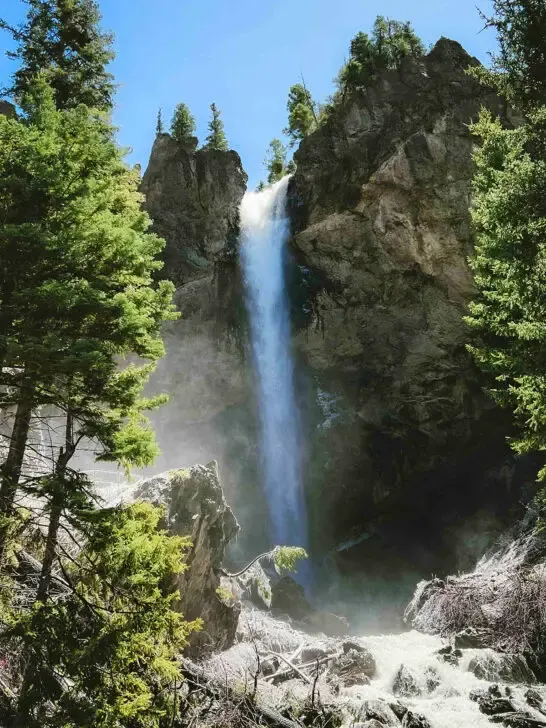
The Fish Creek Falls trail is one of the most iconic Colorado hiking trails. Located just a few minutes from downtown Steamboat Springs, this trail provides visitors with a breathtaking view of a 283-foot waterfall just a 1/4 mile from the trailhead in Routt National Forest.
There is a $5 fee to park (cash or check only). However, parking is free for holders of the America the Beautiful national parks pass. A secondary parking area is about 1/4 mile from the main parking lot, and you’ll also find restrooms in the main parking area.
Once you’ve made the short hike down to the bridge and taken in the stunning view of the waterfall, the out-and-back trek to the “upper falls” begins.
The 1,450-foot elevation gain takes you through the surrounding mountains and groves of Aspen trees with the backdrop of the falls and creek running in the distance. As you near the top of the trail, you’ll find more rugged and rocky terrain that looks out to sweeping valley views and some of the most scenic landscapes in the state.
Reach the top, and you’ll find the smaller but more secluded second falls. This is a great spot to kick off your hiking shoes and reward yourself by dipping your feet in the calm pools of mountain water.
For the more adventurous hikers, climb up the slippery rocks and jump into the chilly pool at the base of the waterfall!
Remember, the falls will run more fiercely in the early to mid-summer due to the snowmelt.
Recommended by Morgan of The Home That Roams
26. Caribou Ranch Open Space

- Hike distance: 4.8 miles
- Time: 1 hour 49 minutes
- Difficulty rating: Easy
- Best time to hike: Fall
About a half-hour west of Boulder, you’ll find Caribou Ranch Open Space just outside of Nederland. The trail is actually two trails. It starts with the DeLonde Trail which turns into Blue Bird Loop.
This is the perfect hike for those who want to spend a couple of hours enjoying the beauty of nature without exerting too much effort. Contrary to other Colorado hikes, the elevation varies between 8,300 and 10,000 feet, which is definitely a plus for anyone sensitive to altitude sickness!
The hike takes you through a forest and then opens up into a meadow. You’ll cross streams that provide water to wildlife like bears, elk, moose, and deer.
Bring your binoculars for the hawks, warblers, and plethora of birds that call the park home depending on the time of year. Caribou Ranch is very protective of its animals, so there is no hunting and no pets allowed.
In addition to the gorgeous scenery and wildlife, you’ll pass a couple of historic structures on the trail. First would be the DeLonde Homestead off the loop portion. Second is the Blue Bird Mining Complex at the most northern part of the trail.
The park closes annually from April 1st through June 30th so elks can calve and birds can migrate without human disruption.
Summer brings the wildflower blooms and fall explodes with golden aspens. In winter, of course, there is snow, and snowshoeing and cross-country skiing is popular.
At the trailhead, there is a small parking lot, restroom, and picnic tables. There are also a few picnic tables scattered throughout the park if you want to pack a lunch.
But if you can make it to any of the amazing restaurants in Boulder for a meal afterward, that’s a much better reward!
Recommended by Denise of Chef Denise
Colorado hiking trails

There ya have it! 26 of the very best Colorado hiking trails! Whether you’re hiking solo, as a couple, family or with friends, there’s a trail for everyone in Colorado. From relatively flat terrain to steep inclines, this list of the best Colorado hikes is such a fun combination of views and experiences.
Let’s recap this amazing list one more time, in a condensed list!
Best Colorado hikes
- Sylvan Lake
- Hanging Lake
- Treasure Falls
- South Colony Lakes
- St. Mary’s Glacier
- Mt. Elbert
- Coyote Valley Trail
- Chasm Lake
- Sky Pond
- Alberta Falls
- Siamese Twins Trail
- Manitou Incline
- Sapphire Point Overlook
- Iowa Hill
- Ptarmigan Trail
- Blue Lakes
- Columbine Lake
- Bridal Veil Falls
- Ice and Island Lakes
- Otto’s Trail
- Bennhoff Lake Trail
- Flatiron Loop Trail
- Fourth of July Trail
- Maroon Bells
- Fish Creek Falls
- Caribou Ranch
Related content you might like:
27 Incredible Colorado Bucket List Ideas You’ll Love
12 Epic Scenic Drives Colorado (Map + Tips + Photos)
Denver to Albuquerque Drive: 10 Scenic Stops You Can’t Miss
Find this post helpful? Save it for later or share it on social media!

Ronja
Wednesday 12th of July 2023
Ooh I have so many hikes planned for when I visit the US! Now I got a couple of more to add to the list!
Nikki
Thursday 13th of July 2023
Awesome, Ronja! I hope you get to enjoy some of these!
Planashleygo
Wednesday 12th of July 2023
Wow, this article has got me itching to grab my hiking boots and head straight to Colorado! The sheer variety and beauty of the hiking trails in the state are truly awe-inspiring.
The inclusion of the best time to hike each trail in this guide is a thoughtful touch. It allows hikers to plan their adventures accordingly and make the most of their experiences.
Nikki
Thursday 13th of July 2023
Thanks Ashley! Colorado is an amazing state for hiking. Hope you get to make it there (and use this resource) soon!
Jenn
Wednesday 12th of July 2023
Wow I loved Hanging Lake and all of the photography! What a well written blog post!
Nikki
Thursday 13th of July 2023
Thanks Jenn! Colorado is such a beautiful state, offering so much for those looking to explore it.
Kelly
Wednesday 12th of July 2023
This guide was so detailed and insightful! After reading all your recommendations I'll definitely be adding Colorado to my travel bucket list for a future trip.
Nikki
Thursday 13th of July 2023
Awesome, Kelly! I'm glad you found some inspiration here!
Indrani
Wednesday 12th of July 2023
That Satellite Communicator is a helpful suggestion. The mention of distances helps in planning the trip out. I am love with your pictures of the place. Hope I will be able to do them some day.
Nikki
Thursday 13th of July 2023
Oh yay Indrani! I hope you make it to Colorado for hiking, too :)